On October 13, 2025, the Long March 2D carrier rocket launched the Experiment-31 optical remote sensing satellite into orbit from the Jiuquan Satellite Launch Center, marking my country's official entry into the era of 0.1-meter resolution spaceborne imaging technology.
In traditional high-resolution satellite images with 0.5-meter resolution, building outlines still appear jagged and blurry. However, the test data transmitted back by the Experiment-31 satellite can already distinguish the tire treads of vehicles in a parking lot. This leap forward stems from three key technological breakthroughs: the adaptive optics system achieved real-time aberration correction in a space environment for the firsts time, the quantum dot sensor increased photon capture efficiency to three times that of traditional CCDs, and the deep learning algorithm improved the accuracy of raw data by five times.
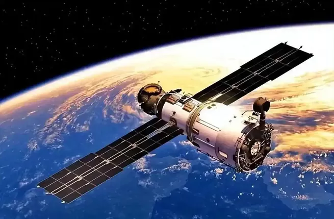
In orbit 500 kilometers above the Earth, the Experiment-31 satellite's micro-electromechanical deformable mirror completes 2000 surface adjustments per second, compensating for wavefront distortion caused by atmospheric turbulence. An academician of the Chinese Academy of Sciences disclosed that the indium gallium arsenide quantum dot sensor used can maintain full load operation during twilight hours, solving the problem of imaging in low-light environments. More importantly, the onboard AI processor can complete noise filtering and feature enhancement before data transmission, allowing for usable images to be obtained in a single pass.
The satellite's applications in land surveying have already shown disruptive value: monitoring data from the construction site of Beijing's new airport shows that the system can capture ground subsidence of 0.8 millimeters. In the field of ecological protection, test images from Xishuangbanna, Yunnan, accurately marked the missing individual tree crowns caused by illegal logging. The Ministry of Emergency Management confirmed that its disaster response efficiency within 72 hours has increased fourfold compared to before, and the time required for road damage assessment in the Sichuan earthquake-stricken area has been shortened from 3 days to 6 hours.
This launch verified the freeform surface optical system independently developed by the Changchun Institute of Optics, Fine Mechanics and Physics, whose performance parameters have surpassed those of the current US KH-12 satellite. It is worth noting that the satellite's core components of the quantum sensor are 100% domestically produced, including the terahertz modulation chip developed by the Xi'an Institute of Microelectronics. The China Aerospace Science and Technology Corporation (CASC) revealed that this technology will be applied to the "Huan Yu" high-precision remote sensing constellation, which is scheduled to be networked in 2026.
With the successful completion of in-orbit testing of the Experiment-31 satellite, China has become the third country in the world to master 0.1-meter resolution commercial remote sensing technology. The next step will focus on breakthroughs in on-orbit AI target recognition technology, enabling satellites to directly output analysis results such as ship types and crop growth status. This evolutionary race of space-based eyes is redefining the dimensions of how humanity perceives the Earth.
In October 2025, the Gravity-1 Y2 rocket lifted off from Haiyang, Shandong, sending the Jiangsu Geology satellite into orbit. More than three hours later, the satellite had already transmitted images of Kemerovo, Russia. Ground details were clearly visible at 0.5-meter resolution, and the color layers were even richer than expected.
This speed is unusual. Or rather, this efficiency exceeds conventional understanding.
The success of the Jiangsu Geology satellite is based on two technological foundations. Gravity-1, as the world's largest solid-fuel rocket, lifted off with a 30-meter body and a weight of 405 tons. Its configuration is unique, with a core stage and four boosters. This design provides stability for sea launches, allowing it to perform complex trajectory adjustments even in waves. They call it the "Phoenix Tail Swing," a forty-degree turning maneuver.
The high-resolution remote sensing field now has a new participant. The landscape of this field is changing.
The Jiangsu Geology satellite has solved the industry problem of balancing high resolution and wide swath coverage. This satellite is equipped with an off-axis four-mirror optical camera, achieving 0.5-meter resolution and a 150-kilometer swath width in a 535-kilometer orbit. The Jiangsu Geology satellite's lens width is 150 kilometers, and a single shot can cover a quarter of Jiangsu Province; four images can complete a scan of the entire province. This efficiency makes traditional satellites seem slow. Chinese commercial remote sensing is undergoing a transformation, from being able to image to fast imaging, and then to intelligent imaging.
However, even the most advanced optical satellites have a fatal weakness—they are afraid of darkness and clouds. Once faced with cloudy or rainy weather, or nighttime, even the most powerful "eyes" become useless. Does this mean our "super eye" is so dependent on clear weather? Of course not. To overcome this limitation, China has unveiled another cutting-edge technology – Synthetic Aperture Radar (SAR) satellites. You can think of it as similar to a bat's echolocation; it actively emits radar waves and receives the echoes to create images, completely unaffected by clouds, rain, fog, or darkness. The leading example, the "Land Exploration-1 01 Group" satellite, acts like a doctor performing a CT scan on the Earth, able to penetrate the surface and reveal deeper information.
Now we have "eyes" that can work around the clock, but a new problem arises. The sheer volume of data transmitted daily by hundreds of satellites is astronomical, forming a "data ocean." Analyzing this data manually, image by image, would be like searching for a needle in a haystack. Therefore, a smarter "super brain" was needed – Artificial Intelligence (AI). Currently, Changguang Satellite Company's "Remote Sensing AI" platform can automatically identify and frame ships in major global ports, aircraft at airports, and even track changes in their numbers in real time, much like playing a real-time strategy game. As experts from the Chinese Academy of Sciences have stated, AI technology is transforming massive amounts of static remote sensing imagery into dynamic, actionable "live intelligence," increasing efficiency hundreds or even thousands of times.
This AI-powered "eye in the sky" is profoundly changing the world we live in. For a long time, the highest-resolution remote sensing data was almost entirely monopolized by a few countries like the United States. To see the world clearly, we often had to rely on others. Now, the rise of constellations like "Jilin-1" has not only given us "data freedom," but also the ability to provide data services to our partners along the Belt and Road Initiative, representing a real increase in geopolitical influence and soft power. Of course, this powerful observation capability is also a crucial safeguard for national security, constituting a "capability reserve" that gives us more confidence and leverage in a complex and ever-changing international environment.
More importantly, this "eye in the sky" has already entered the lives of ordinary people. It can help farmers accurately identify which fields lack water and which crops are not growing well, enabling precise fertilization and cost savings; it can help city managers monitor traffic flow in real time, intelligently control traffic lights, and alleviate congestion; before natural disasters such as typhoons and floods strike, the data it provides allows for earlier and more accurate warnings, adding a solid layer of protection for life and property. It is no longer a high-tech luxury, but a "guardian" that is permeating every aspect of our lives. Disclaimer: Articles marked as sourced from the internet have not been verified by the association for their originality, and the accuracy, completeness, and timeliness of the statements and content within are not guaranteed or promised by this website. Readers should use this information for reference only and verify the relevant content independently.